Corona Satellite Calibration Targets.


Name: Corona Satellite Calibration Targets
Constructed: 1967
Location: South of Casa Grande, Arizona
Coordinates: 32.806996° N, -111.722192° W
Manifestation Method: Concrete
Macros: line, perpendicular, circle
[want to zoom in to see the individual crosses? take a look at the map of distribution here]
A little bit of background:
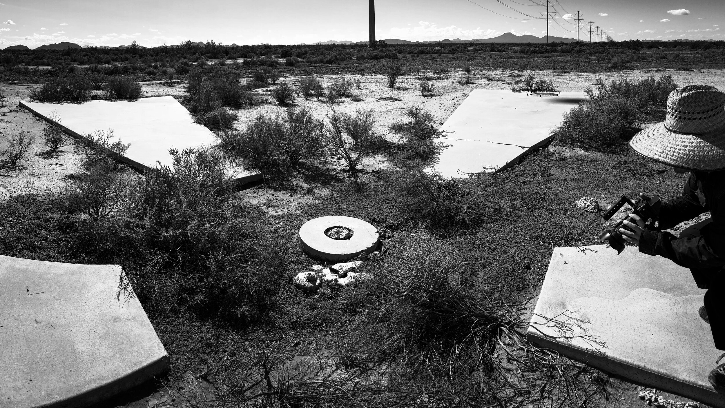
Drive far enough out into the Sonoran desert in Arizona, and you might just stumble across strange, large crosses dotted across the dusty landscape. Spaced apart in a one-mile-grid, at a glance they seem to be the remnants of something long gone. That is not completely false. These concrete targets were built in 1967 during the Cold War era. For about a decade before their construction, satellites were launched with 77mm film tucked away. They were then sent over Russia and China to snap surveillance photographs of the landscape below, and once they were full they would eject the used film. The roll would then parachute down to be intercepted by a passing a plane.
“So what is the purpose of these crosses?” You might ask. The surveillance was already happening; however, properly focusing the cameras and understanding the scale of photographed landscapes were ongoing problems. These concrete crosses were designed to combat these problems - providing a place where satellites could calibrate their cameras, and photographs that give a sense of reference for scale. Since we know that each of these crosses is sixty feet across, photographs taken halfway across the globe could be compared to them, a ruler of the sky.

The Geometry:
Each target is composed of a trapezoid rotated around a central circle. Perpendicular lines provide the framework to layout the trapezoids.
The system of targets is a grid, with each target existing at a node.
photographs Rosa Menkman / CC 2.0